Dixie Canyon Park Sherman Oaks Trail Map and Hiking History
Nestled within 20 acres of protected Santa Monica Mountains wilderness, Dixie Canyon Park offers Sherman Oaks residents a quiet, creek‑side escape that blends natural beauty with a...

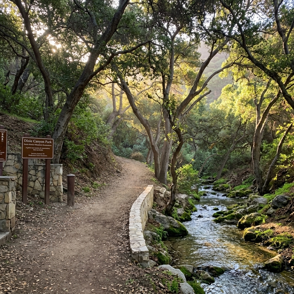
Sherman Oaks · Community Photo
Nestled within 20 acres of protected Santa Monica Mountains wilderness, Dixie Canyon Park offers Sherman Oaks residents a quiet, creek‑side escape that blends natural beauty with a rich conservation story. In 1986 actor Warren Beatty donated the land to the Santa Monica Mountains Conservancy, and the park’s restored entrance was officially dedicated on April 3, 1994 by then‑Los Angeles Councilman Zev Yaroslavsky. The modest 0.55‑mile loop trail climbs roughly 175 feet, delivering a micro‑hike that feels like a true mountain adventure. Hikers can start at the parking area at the end of Dixie Canyon Place, observe neighborhood parking etiquette, and follow a clear trail‑map that winds alongside a perennial stream through black‑walnut and coast‑live‑oak woodlands. Dogs are welcome, and entry is free, making the park an accessible option for families, fitness enthusiasts, and anyone eager to explore local ecology. Along the way, interpretive signs highlight the area’s native flora and the stewardship role of the Mountains Recreation & Conservation Authority, which manages the preserve. Whether you’re seeking a quick afternoon trek or a deeper connection to Sherman Oaks’ natural heritage, the park’s blend of history and trail experience invites repeat visits. For those researching the full story, the focus keyword phrase dixie canyon park sherman oaks trail map and hiking history captures the essence of this hidden mountain gem.
Discover Dixie Canyon Park
Nestled on the northern slopes of the Santa Monica Mountains just south of Ventura Boulevard, Dixie Canyon Park offers a quiet escape for residents of Sherman Oaks and surrounding neighborhoods. This 20‑acre open‑space preserve was donated to the Conservancy by actor Warren Beatty in 1986 and is today managed by the Mountains Recreation and Conservation Authority.
The canyon’s heart is a gentle dirt loop that measures roughly 0.55 to 0.6 miles round trip, climbing about 175 feet. Hikers experience a shaded trek beneath dense canopies of California black walnuts and coast live oaks, while a perennial creek adds the sound of running water to the woods. The trail’s modest length makes it perfect for families, dog walkers, and anyone seeking a brief immersion in Southern California wilderness.
Location: End of Dixie Canyon Place, south of Ventura Boulevard.
Size: 20 acres of protected woodland.
Flora: Native black walnut and coast live oak stands.
Water: Seasonal creek that winds through the canyon floor.
Trail: Approximate 0.55‑mile loop with 175 ft elevation gain.
For those searching for a dixie canyon park sherman oaks trail map and hiking history, the park’s official page provides a downloadable map and details on the 1994 entrance restoration dedicated by former councilman Zev Yaroslavsky. Whether you are a local explorer or a visitor looking to unwind, this hidden mountain gem delivers a serene, easily accessible nature experience just minutes from the urban rhythm of Los Angeles.
Parking is convenient on the nearby streets, and the trail is free to access year‑round. Bring a water bottle, enjoy the shade, and let the quiet of the canyon refresh your day.
The Conservation and Hiking History of Dixie Canyon Park
Conservation Origins
In 1986 actor Warren Beatty purchased a 20‑acre canyon in the Sherman Oaks foothills to stop a proposed residential subdivision. He then donated the land to the Santa Monica Mountains Conservancy, securing its protection as public open space. The donation marked a pivotal moment in the park history of the area, preserving native black walnut and coast live oak woodlands along a perennial stream. After years of illegal grading that blocked access, the Conservancy repaired the entrance and, in April 1994, held a dedication ceremony led by Los Angeles Councilman Zev Yaroslavsky. During the event he described the new preserve as “another piece in the overall mosaic” of urban parklands, underscoring the community‑wide value of the space.
Stewardship and Trail Care
The Mountains Recreation & Conservation Authority (MRCA) now manages the site, overseeing trail maintenance, habitat protection, and visitor safety. The single hiking loop, a micro‑hike of approximately 0.55 miles round‑trip with about 175 feet of elevation change, offers a concise yet rewarding hiking history for locals and visitors alike. MRCA’s 24/7 stewardship ensures that the trail remains open, free of fees, and that the riparian corridor continues to support native wildlife. By keeping the entrance well‑maintained and providing clear signage, the agency helps Sherman Oaks residents enjoy a green haven just off Ventura Boulevard without disrupting the surrounding neighborhood.
For anyone looking for the dixie canyon park sherman oaks trail map and hiking history, the park’s modest length and gentle grade make it an ideal entry point to the larger Santa Monica Mountains trail system, while its conservation story stands as a testament to local advocacy and lasting public benefit.
Dixie Canyon
Park
Trail guide, hiking history & conservation story for one of the Santa Monica Mountains' hidden woodland gems.

Trail At a Glance
Route Breakdown
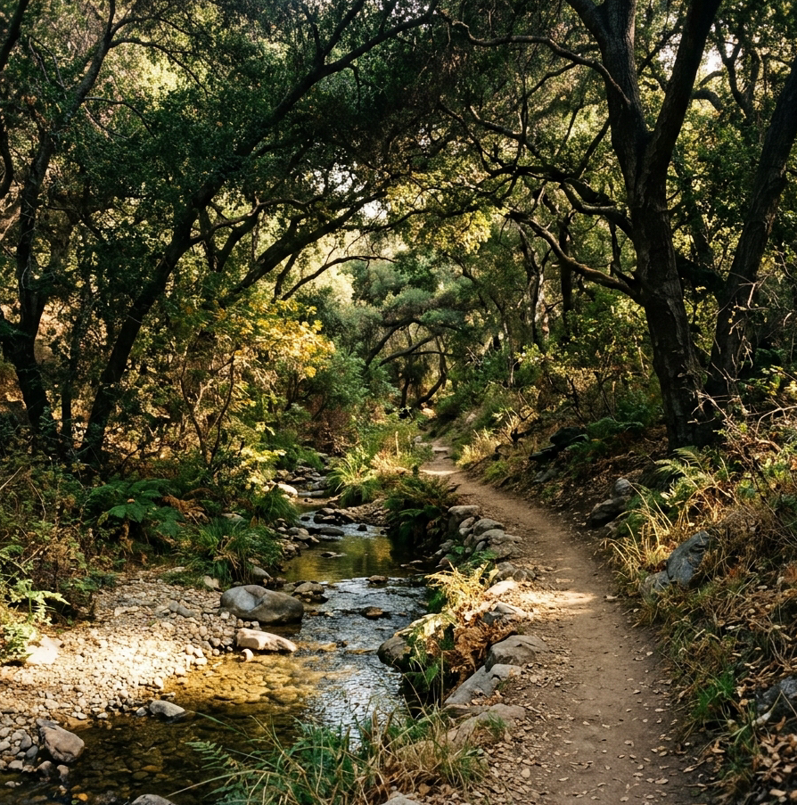
The trail enters the canyon and follows a perennial stream uphill through a dense canopy of native trees. At the ⅓-mile mark, the path arcs around the back of the canyon before looping back, making it surprisingly immersive for such a compact route.
Milestones in the Park's History
Land Donation by Warren Beatty
Actor Warren Beatty contributed 20 acres of canyon land in Sherman Oaks to the Santa Monica Mountains Conservancy, creating the foundation for Dixie Canyon Park.
1994
Restored Entrance Dedication
The newly rebuilt entrance was formally dedicated in April 1994 by conservation officials and then-Los Angeles Councilman Zev Yaroslavsky, marking the park's public opening following restoration work.
MRCA Stewardship
The Mountains Recreation & Conservation Authority (MRCA) manages the preserve — maintaining trails, protecting native woodland, and keeping the park open 24/7 for the community.
Conservation & Community Impact
Rare Woodland Habitat
Preserves a shaded native woodland within the Santa Monica Mountains — a wildlife corridor and green buffer for neighboring Sherman Oaks streets.
Native Tree Species
California black walnut and coast live oak woodlands thrive here, maintained through MRCA stewardship and community volunteer efforts.
Community-Driven Care
Local groups including the Dixie Canyon Association assist with habitat monitoring and volunteer trail upkeep, reinforcing the park's role as a community open space.
Why Dixie Canyon Park Matters Today
From its 1986 inception as a generous land donation to the 1994 dedication that secured public entry, the park's history shows how local advocacy can turn threatened canyon terrain into a lasting recreational asset. Hikers enjoy a short, free trail that showcases native ecosystems, while the surrounding community gains a protected green space that enhances neighborhood livability and ecological health.

Trail Map for Dixie Canyon Park: Navigating the Loop
Trail Length | Elevation Gain | Trail Difficulty | Route Type | Trail Surface | Time Needed | Dog Policy | Management | Trail Map |
|---|---|---|---|---|---|---|---|---|
0.55 mi round‑trip | ≈ 175 ft | Easy to Moderate micro‑hike | Partial loop / lollipop single‑track | Natural dirt, stone steps, wooden footbridges | 20–35 minutes | Leashed (6‑foot) dogs allowed | Mountains Recreation & Conservation Authority (MRCA) | Official MRCA map |
Entrance and Trailhead
Start your hike at the top of Dixie Canyon Place in Sherman Oaks. Street parking lines the road, and a short set of stone steps leads past the official park marker that notes the land donation by actor Warren Beatty in 1986. This point marks the beginning of the Dixie Canyon Park trail.
Canyon Floor Walk
From the steps, follow the path for 250 feet along the canyon floor. The trail runs beside a babbling perennial stream shaded by towering coast live oaks and native black walnuts, offering a cool, shaded start to the hike.
Loop Junction
After roughly 0.08 miles, you reach a small footbridge and a junction where the single‑track splits into the park’s loop. The junction is a natural landmark on any trail map of the area.
Counter‑Clockwise Loop
To hike the loop counter‑clockwise, bear right at the junction and ascend the canyon wall via a narrow dirt single‑track. Continue up the upper slope for about 1/3 mile; gaps in the brush provide filtered panoramic views of the San Fernando Valley. This section adds most of the trail length and showcases the park’s woodland ecosystem.
Descent and Return
Finish the loop by following gradual switchbacks that wind through large oak groves. The descending path brings you back to the canyon‑floor junction, completing the 0.55‑mile loop.
Hiking Tips
Poison oak: Watch for poison oak and dense brush along the narrow sections of the single‑track.
Footwear: Wear sturdy, supportive shoes to handle loose dirt and occasional slick rocks.
Consult a recent trail map before heading out to confirm parking location and any seasonal trail notices.
For those interested in the broader context, the dixie canyon park sherman oaks trail map and hiking history reflects both the natural beauty and the historical contributions that shaped this modest urban oasis.
Every Thursday — local news, events, deals, and new listings. Free forever.
California Black Walnut & Coast Live Oak Canyon Ecosystem

Park Overview
Perched above the San Fernando Valley, Dixie Canyon Park is a 20‑acre open‑space preserve in Sherman Oaks. The land was donated to the Mountains Recreation & Conservation Authority by actor Warren Beatty in 1986, and the park entrance was restored and dedicated in April 1994. Visitors seeking the dixie canyon park sherman oaks trail map and hiking history will find a quiet green corridor that blends natural beauty with urban accessibility.
Flora
The centerpiece of the park’s ecosystem is a rare California black walnut woodland (Juglans californica) intertwined with majestic coast live oak groves (Quercus agrifolia). A perennial stream creates a moisture‑rich microclimate that sustains lush understory plants such as sword ferns, maidenhair ferns, California sagebrush, and hardy chaparral shrubs. This diverse plant community forms the foundation of the preserve’s ecological health.
Fauna
The dense canopy and steady water source support a vibrant wildlife habitat. Hikers may glimpse mule deer navigating the underbrush, hear California scrub‑jays calling from oak branches, and watch acorn woodpeckers tap at tree trunks. Red‑tailed hawks often soar overhead, while a variety of beneficial insects pollinate and decompose, maintaining the balance of this urban wilderness.
Conservation
To protect the fragile root systems and native seed banks, visitors are strongly urged to remain on the marked single‑track trail. Staying on the path reduces erosion, safeguards the rare black walnut and oak seedlings, and preserves the integrity of the park’s unique ecosystem for future generations.
Trailhead Directions, Parking, and Practical Hiking Tips
Directions
From Ventura Boulevard in Sherman Oaks, head south on Dixie Canyon Avenue, turn onto Dixie Canyon Place, and follow it to the cul‑de‑suite turnaround at the road’s end where the stone steps lead to the trailhead.
Parking Realities
Trailhead spaces: Only two small designated parking spaces sit directly at the trailhead entrance.
Street parking: Additional spots are available on surrounding residential streets, but drivers must obey posted signage, avoid blocking driveways, and respect the neighborhood’s quiet‑hour expectations.
Park Hours
Open daily from sunrise to sunset (dawn to dusk).
Dog‑Friendly Policy
Leashed dogs are permitted on all paths. Owners should carry waste bags and pack all waste out, in accordance with official park guidelines.
Safety & Recommendations
Poison oak caution: The single‑track sections often feature poison oak; wearing long pants reduces skin contact.
Tick awareness: After the hike, thoroughly check clothing and skin for ticks.
Footwear: Choose shoes or boots with good tread to handle dirt switchbacks and uneven canyon terrain.
Hiker Etiquette and Leave No Trace in Dixie Canyon Park
Dogs are welcome on the 0.55‑mile loop, but the official park guidelines require every pet to be kept on a leash at all times. Pack out all pet waste to protect the delicate California black walnut and coast live oak roots that line the narrow canyon trail.
Because the trailhead sits in a tight residential cul‑de‑sac at the end of Dixie Canyon Place, hikers should be mindful of neighbors. Keep noise to a minimum, avoid lingering near driveways, and do not block the limited street turn‑around. Respectful parking helps preserve good relations with the Sherman Oaks community.
The canyon’s brush and perennial stream create a high‑fire‑risk environment. Open flames, campfires, and smoking are strictly prohibited throughout Dixie Canyon Park. This zero‑fire policy reduces the chance of a wildfire spreading to nearby homes and natural habitats.
Stay on the designated single‑track loop at all times. The trail’s narrow dirt path protects fragile root systems and prevents erosion of the steep canyon slopes. Straying off‑trail can damage native vegetation and accelerate sediment runoff that would affect the downstream stream.
Following these simple rules ensures that the park remains a clean, safe, and enjoyable space for hikers, pet owners, and local residents alike. By honoring the official park guidelines, each visitor helps preserve the natural beauty and community spirit of Dixie Canyon Park for years to come.
Fryman Canyon & Longridge Park in Sherman Oaks parks
Trail Comparison Overview
For those seeking the dixie canyon park sherman oaks trail map and hiking history, Dixie Canyon offers a 0.55‑mile shaded micro‑trail that weaves through a perennial stream and dense black‑walnut woodland. The experience contrasts sharply with the bustling loops found in many Sherman Oaks parks.
Side‑by‑Side Snapshot
Dixie Canyon Park – 0.55 mi round‑trip, ~175 ft elevation, free street parking, deep shade, high solitude.
Fryman Canyon – Approx. 3 mi loop, ~450 ft elevation, paid lot ($7/2 hr, $14/4 hr), wide fire road, heavy foot traffic.
Longridge Park – About 0.4 mi out‑and‑back, 75‑100 ft elevation, free street access, open ridge with striped sandstone.
When to Choose Dixie Canyon
Quick quiet stroll under canopy for a 15‑20‑minute nature break.
Post‑work decompress away from crowds and parking fees.
Birdwatching or solitary reflection beside a bubbling stream.
When to Choose Fryman Canyon
Longer cardio workout requiring sustained endurance.
Socializing with fitness groups on a well‑traveled fire road.
Seeking sweeping valley vistas typical of Santa Monica Mountains hikes.
Why Longridge Park Still Matters
Longridge Park delivers a compact ridge trek with striking sandstone and panoramic views, making it a solid alternative when you want a slightly longer hike than Dixie Canyon but without the crowds of Fryman Canyon.
Hiker Factor | Dixie Canyon Park (Sherman Oaks parks) | Fryman Canyon (Wilacre Park) | Longridge Park |
|---|---|---|---|
Total Distance | 0.55 mi RT | ~3.0 mi loop (variants range from 2.6 to 3.3 mi) | ~0.6 mi RT (sources also note 0.4 mi RT variant) |
Elevation Change | 175 ft gain | 450 ft gain (approx. 450–463 ft reported) | 120 ft gain (sources note 75 ft on specific shortened segments) |
Crowd Level | Low / Quiet | High / Very busy | Low / Quiet |
Shade Coverage | High (Oak & Walnut canopy) | Moderate / Partially exposed | Moderate |
Trail Type | Narrow single‑track loop | Wide dirt road & single track | Dirt path |
Best For | Quick peaceful nature immersion & birding | Cardio workouts & social hiking | Short hillside stroll |
FAQ: Dixie Canyon Park in Sherman Oaks
With a round‑trip distance of roughly 0.55 miles and a modest 175‑foot elevation gain, the loop in Dixie Canyon Park is an ideal micro‑hike for children and beginners. Parents should watch the steeper switchbacks and keep kids away from dense vegetation.
This answer appears in the local FAQs and reflects common community reviews that praise the trail’s brevity and scenery.
For those seeking the dixie canyon park sherman oaks trail map and hiking history, the park’s visitor kiosk provides a concise sketch of the route.
Dogs are welcome on the trail under the Mountains Recreation and Conservation Authority’s official park guidelines. They must stay on a leash no longer than six feet, and owners are required to pack out all pet waste.
Leash compliance helps keep the trail safe for hikers of all ages.
Poison oak grows naturally along parts of the canyon floor and narrow single‑track path. It is most noticeable in spring and early summer. Wearing long pants and staying in the center of the trail reduces the risk of contact.
Hikers should also brush away any low‑lying branches that may harbor the plant.
Parking at the trailhead on Dixie Canyon Place is limited to a couple of spaces. When the lot fills, visitors typically park along the adjoining residential street, observing any street‑cleaning signs and avoiding driveways.
Quiet parking and respectful noise levels honor the neighborhood’s character.
Dixie Canyon Park is an undeveloped 20‑acre preserve; there are no restrooms, drinking fountains, or trash cans on site. Hikers must bring sufficient water and pack out all waste, following Leave No Trace principles.
These conditions are outlined in the official park guidelines for the area.